Çavur, Mahmut
Loading...

Profile URL
Name Variants
Çavur, Mahmut
M.,Çavur
M. Çavur
Mahmut, Çavur
Cavur, Mahmut
M.,Cavur
M. Cavur
Mahmut, Cavur
cavur, mahmut
Çavur, Mehmet
Cavur, M.
Çavur, M.
M.,Çavur
M. Çavur
Mahmut, Çavur
Cavur, Mahmut
M.,Cavur
M. Cavur
Mahmut, Cavur
cavur, mahmut
Çavur, Mehmet
Cavur, M.
Çavur, M.
Job Title
Email Address
Main Affiliation
Management Information Systems
Management Information Systems
03. Faculty of Economics, Administrative and Social Sciences
01. Kadir Has University
Management Information Systems
03. Faculty of Economics, Administrative and Social Sciences
01. Kadir Has University
Status
Former Staff
Website
ORCID ID
Scopus Author ID
Turkish CoHE Profile ID
Google Scholar ID
WoS Researcher ID
Sustainable Development Goals
 1
1NO POVERTY
0
Research Products
 2
2ZERO HUNGER
2
Research Products
 3
3GOOD HEALTH AND WELL-BEING
0
Research Products
 4
4QUALITY EDUCATION
1
Research Products
 5
5GENDER EQUALITY
0
Research Products
 6
6CLEAN WATER AND SANITATION
0
Research Products
 7
7AFFORDABLE AND CLEAN ENERGY
3
Research Products
 8
8DECENT WORK AND ECONOMIC GROWTH
1
Research Products
 9
9INDUSTRY, INNOVATION AND INFRASTRUCTURE
0
Research Products
 10
10REDUCED INEQUALITIES
0
Research Products
 11
11SUSTAINABLE CITIES AND COMMUNITIES
2
Research Products
 12
12RESPONSIBLE CONSUMPTION AND PRODUCTION
0
Research Products
 13
13CLIMATE ACTION
0
Research Products
 14
14LIFE BELOW WATER
1
Research Products
 15
15LIFE ON LAND
2
Research Products
 16
16PEACE, JUSTICE AND STRONG INSTITUTIONS
0
Research Products
 17
17PARTNERSHIPS FOR THE GOALS
0
Research Products
This researcher does not have a Scopus ID.
This researcher does not have a WoS ID.
Scholarly Output
19
Articles
13
Views / Downloads
155/1588
Supervised MSc Theses
3
Supervised PhD Theses
0
WoS Citation Count
87
Scopus Citation Count
142
Patents
0
Projects
0
WoS Citations per Publication
4.58
Scopus Citations per Publication
7.47
Open Access Source
13
Supervised Theses
3
| Journal | Count |
|---|---|
| Remote Sensing | 2 |
| Politeknik Dergisi | 2 |
| IMCET 2019 - Proceedings of the 26th International Mining Congress and Exhibition of Turkey -- 26th International Mining Congress and Exhibition of Turkey, IMCET 2019 -- 16 April 2019 through 19 April 2019 -- Antalya -- 151960 | 1 |
| Journal of Cultural Heritage Management and Sustainable Development | 1 |
| Journal of Polytechnic | 1 |
Current Page: 1 / 3
Scopus Quartile Distribution
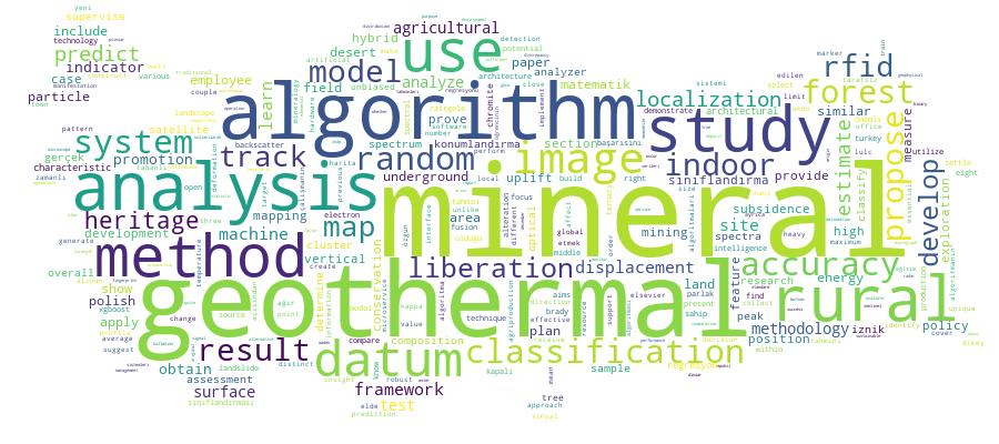
Competency Cloud
19 results
Scholarly Output Search Results
Now showing 1 - 10 of 19
Article Tarafsız 3d Mineral Harita Tahminleri Elde Etmek için Random Forest Tree Sınıflandırması Kullanılarak Epoksi Bloklardaki Dikey Kesitlerin Değerlendirilmesi(2021) Camalan, Mahmut; Çavur, MahmutAlansal mineral haritaları, epoksi reçinenin dibine çöken cevher tanelerinin yüzeylerini içeren parlak kesitlerinden yapılmaktadır.Fakat, ağır mineraller nispeten dibe çökebilmekte ve parlak yüzeyi ağır mineraller açısından zengin yapabilmektedir. Bu ise parlakkesitlerden hesaplanan alansal (2D) mineral haritalarının, hacimsel (3D) haritaların taraflı tahminleri haline gelmesine sebepolabilmektedir. Bu çalışma, parlak kesite dik olarak (parçacıkların çökelme yönü boyunca) alınan rastgele bir kesitin bir kromitcevheri numunesinin 3D mineral haritasının tarafsız bir tahmini olarak kullanılıp kullanılamayacağını test etmeyi amaçlamaktadır.Bu çalışmanın amacı için, dikey kesitlerin 2D haritaları, öncesi ve sonrası görüntü işleme araçlarıyla bütünleşmiş Random Forestsınıflandırmasıyla elde edilmiştir. Daha sonra, 2D haritalar, stereolojik hatalar olmadığı varsayılarak 3D mineral haritalarınadönüştürülmüştür. 3D haritalardan tahmin edilen modal mineraloji ve tane boyu dağılımları, sırasıyla XRD ve kuru elemeanalizlerinden tahmin edilen sonuçlarla karşılaştırılmıştır. Herhangi bir 2D harita gerçek analizlere yakın modal mineraloji ve taneboyu dağılımı veriyorsa, bu 2D harita cevher numunesinin 3D haritasının tarafsız bir tahmini olarak seçilmiştir. Bu çalışmanınsonuçları herhangi bir dikey kesitin, ağır minerallerin öncelikli olarak çöktüğü parlak kesitten farklı olarak gerçek 3D haritanıntarafsız bir tahmini olacağını desteklemektedir.Conference Object Citation - Scopus: 28Land Use and Land Cover Classification of Sentinel 2-A: St Petersburg Case Study(International Society for Photogrammetry and Remote Sensing, 2019) Çavur, Mahmut; Düzgün, Hafize Şebnem; Kemeç, Serkan; Demirkan, Doğa ÇağdaşLand use and land cover (LULC) maps in many areas have been used by companies, government offices, municipalities, and ministries. Accurate classification for LULC using remotely sensed data requires State of Art classification methods. The SNAP free software and ArcGIS Desktop were used for analysis and report. In this study, the optical Sentinel-2 images were used. In order to analyze the data, an object-oriented method was applied: Supported Vector Machines (SVM). An accuracy assessment is also applied to the classified results based on the ground truth points or known reference pixels. The overall classification accuracy of 83,64% with the kappa value of 0.802 was achieved using SVM. The study indicated that of SVM algorithms, the proposed framework on Sentinel-2 imagery results is satisfactory for LULC maps.Master Thesis Rssi-Based Hybrid Algorithm for Real-Time Pedestrian Tracking in Indoor Environments by Using Rfid Technology(Kadir Has Üniversitesi, 2019) Demir, Ebubekir; Çavur, MehmetThe usage and importance of Location Based Services for indoor environments are increasing recently. The knowledge of the exact and real-time location is required by many of these services. Since Global Positioning System (GPS) is not designed for indoor environment, new positioning systems based on new technologies and methods are needed for these type of environments. In this thesis, RFID-based real-time indoor positioning systems and algorithm are developed. Received Signal Strength (RSS) based positioning techniques, are studied in detail. A hybrid algorithm is developed which depends on the mainly fingerprinting. The advantages of each method are emphasized. An original and unique hybrid algorithm is developed in this study in order to overcome available algorithm's' drawbacks. The algorithm and methodology is tested in two different indoor environments. As a result, the accuracy of this original and unique methodology and algorithm is 2,5 m.Article Citation - WoS: 12Citation - Scopus: 16Rssi-Based Hybrid Algorithm for Real-Time Tracking in Underground Mining by Using Rfid Technology(Elsevier, 2022) Cavur, Mahmut; Demir, EbubekirKnowing the precise and real-time location of underground mining workers is essential for their health and safety in any emergency. However, the standard Global Positioning System (GPS) is insufficient for such indoor environments as it requires new infrastructure based on different technologies and algorithms. Instead, Radio Frequency Identification (RFID)-based real-time indoor localization systems and a hybrid algorithm are developed. The received-signal-strength (RSS) based positioning techniques are investigated and applied in indoor environments. A unique hybrid approach based on fingerprinting is proposed and developed to solve the disadvantages of the existing techniques. Consequently, the accuracy of this one-of-a-kind algorithm is found to be 2.52 m in an office and 3.13 m in an underground mine. We also compared the proposed hybrid algorithm to the Weighted K-Nearest Neighbor (WKNN). WKNN, on the other hand, has an accuracy of 4.01 m in the office and 4.33 m in underground mining environments. (C) 2022 Elsevier B.V. All rights reserved.Article Citation - WoS: 1Using Random Forest Tree Classification for Evaluating Vertical Cross-Sections in Epoxy Blocks To Get Unbiased Estimates for 3d Mineral Map(Gazi University, 2021) Camalan, Mahmut; Çavur, MahmutAreal mineral maps are constructed from the polished sections of particles that settle to the bottom of epoxy resin. However, heavy minerals can preferentially settle to the bottom, making the polished surface rich in heavy minerals. Therefore, polished sections will become biased estimates of the volumetric (3D) map. The study aims to test whether any vertical cross-section (any section along the settling direction of particles) can be an unbiased estimate of the 3D mineral map of a chromite ore sample. For the purpose of this study, 2D maps of the vertical cross-sections were acquired by using Random Forest classification coupled with image pre- and post-processing tools. Then, 3D mineral maps were converted from 2D maps without assuming stereological errors. The modal mineralogy and particle size distributions predicted from 3D maps were compared with the same features estimated from the particulate sample by XRD and dry sieving analyses, respectively. Any 2D map which yields a modal mineralogy and a size distribution similar to the true analyses was selected as an unbiased estimate of the true 3D map. The results suggest that any vertical cross-section is an unbiased estimate, unlike polished section at which heavier minerals settle preferentially.Article Citation - WoS: 9Citation - Scopus: 12Displacement Analysis of Geothermal Field Based on Psinsar and Som Clustering Algorithms a Case Study of Brady Field, Nevada-Usa(MDPI, 2021) Çavur, Mahmut; Moraga, Jaime; Düzgün, H. Şebnem; Soydan, Hilal; Jin, Ge; Sebnem Duzgun, H.The availability of free and high temporal resolution satellite data and advanced SAR techniques allows us to analyze ground displacement cost-effectively. Our aim was to properly define subsidence and uplift areas to delineate a geothermal field and perform time-series analysis to identify temporal trends. A Persistent Scatterer Interferometry (PSI) algorithm was used to estimate vertical displacement in the Brady geothermal field located in Nevada by analyzing 70 Sentinel-1A Synthetic-Aperture Radar (SAR) images, between January 2017 and December 2019. To classify zones affected by displacement, an unsupervised Self-Organizing Map (SOM) algorithm was applied to classify points based on their behavior in time, and those clusters were used to determine subsidence, uplift, and stable regions automatically. Finally, time-series analysis was applied to the clustered data to understand the inflection dates. The maximum subsidence is -19 mm/yr with an average value of -6 mm/yr within the geothermal field. The maximum uplift is 14 mm/yr with an average value of 4 mm/yr within the geothermal field. The uplift occurred on the NE of the field, where the injection wells are located. On the other hand, subsidence is concentrated on the SW of the field where the production wells are located. The coupling of the PSInSAR and the SOM algorithms was shown to be effective in analyzing the direction and pattern of the displacements observed in the field.Master Thesis Forecasting Employees' Promotion Based on the Personal Indicators by Using a Machine Learning Algorithm(Kadir Has Üniversitesi, 2022) IBRIR, YASMINE AYA; cavur, mahmutJob promotion is considered one of the most important issues of importance in any organization, as it is vital for administrative development, and a means of motivating the worker for self-development and willingness to bear the burden and responsibility of work and the position attached to it, and thus it contributes to providing the necessary needs of the forces of mankind to occupy positions higher on the career ladder. Thus, this study aims to set up a sufficient framework to predict the promotion of an employee in an organization based on a variety of characteristics such as, but not limited to, the number of training, previous year rating, duration of service, awards earned, and average training score. Hence, this framework can be used and generalized to all prediction problems, not just our problem of predicting employee promotion. In this study, we used promotion data provided by Analytics Vidhya Data to test and prove the success of the framework. Our methodology is mainly composed of five phases: Input data, Data Pre processing, Data Manipulation, Data Modeling, and finally Data Evaluation. We constructed a new number of features in this study. Then we used several features including creating features and providing insights into the promotion and commitment of employees and using supervised learning techniques, namely XGBoost, Random Forest, Decision Tree, Logistic Regression, AdaBoost, and Gradient Boosting. Experimental results show that the XGBoost model has a higher accuracy of 94%, proving to be the most efficient. The result is accentuated by the high validation score similar to accuracy and efficiency. It is a very important and valuable study as it is the first study to predict employee promotion using the XGBoost classifier method.Article Citation - WoS: 4Citation - Scopus: 5Development of a Supervised Classification Method To Construct 2d Mineral Maps on Backscattered Electron Images(Tubitak, 2020) Camalan, Mahmut; Çavur, MahmutThe Mineral Liberation Analyzer (MLA) can be used to obtain mineral maps from backscattered electron (BSE) images of particles. This paper proposes an alternative methodology that includes random forest classification, a prospective machine learning algorithm, to develop mineral maps from BSE images. The results show that the overall accuracy and kappa statistic of the proposed method are 97% and 0.94, respectively, proving that random forest classification is accurate. The accuracy indicators also suggest that the proposed method may be applied to classify minerals with similar appearances under BSE imaging. Meanwhile, random forest predicts fewer middling particles with binary and ternary composition, but the MLA predicts more middling particles only with ternary composition. These discrepancies may arise because the MLA, unlike random forest, may also measure the elemental compositions of mineral surfaces below the polished section.Book Part Citation - Scopus: 3Sentinel-1 Sar Verileri Kullanilanarak Maden Kaymalarini ve Deformasyonlarini İzleme [monıtorıng Of Mıne Landslıde And Deformatıon Usıng Sentınel-1 Sar Data](Baski, 2019) Çavur, Mahmut; Camalan, Mahmut; Ketizmen, Hakkı; Ağıtoğlu, SuudIn this study, an original DInSAR method was used to monitor landslides and deformation in a coal mine area. The open-pit mine operation belonging to the Ciner Group in Silopi, Sirnak was selected fort he case study. Between 21 November 2017 and December 31, 2017, 2-month Sentinel-1 data were analyzed every 12 days and interferometric results were obtained. It has been shown that the DInSAR method can be used effectively in order to monitor the mineral movements by using satellite images. The results of the analysis were reported in mm and accuracy analysis was performed on the field. SNAP, Cygwin, and ArcGIS 10.4 software are used for reporting and analysis purposes. The maximum subsidence was measured by radar as 45 mm. The mean subsidence rate of one class was found to be 45 mm as landslide and 46 mm as uplift where cracks most severely developed. The proposed method is an effective method for mining in order to determine the effects that may occur as a result of landslides, displacement, and uplift caused by underground and surface mining.Article Citation - WoS: 1Yereraltı Maden İşçilerini Gerçek Zamanlı Takip Etmek İçin Rfıd Teknolojisine Dayalı Özgün Bir Entegrasyon Metodolojisi(Gazi Universitesi, 2018) Çavur, MahmutIn recent years many companies want to keep track of their employees sources and working machines due to various reasons like security coordination performance monitoring. The purpose and requirements are the main factors that determine the methodology of tracking. The real-time tracking can be determined with high precision in open areas with the global positioning system (GPS). However previous research and developments for indoor tracking have mostly focused on infrared wireless LAN and ultrasonic. In this study a Radio-Frequency Identification (RFID) protocol and interface are integrated into an open source Information Systems (IS) software. A tight coupling methodology is developed for integration of RFID into an open source software. The use of open source software as a common interface also provides better spatial display and analysis capabilities. The tracking algorithm is completely unique original and it is encoded in the Java programming language. In the algorithm the accuracy of locating the proximity direction of miners and whether the RFID tag is on the right and left of the last point of RFID receiver is determined with 20 m accuracy. The system was tested in an underground salt mine. The developed methodology and system are now being commercialized in Turkey.
